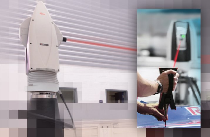
From building prototypes, reverse engineering, and tool inspections to installation and application in the motor and aviation industries, quality demands in manufacturing are extremely high and safety-critical. There is no way around using optical systems for production control and quality assurance: surveying systems play a central role in greatly improving the values achieved technically, as well as optimising the efficiency of their activity.
One of the leading agents in this market is Leica Geosystems. With its headquarters in Heerbrugg, Switzerland, the company is part of the internationally active Hexagon Group. Leica specialises in solutions for the most diverse range of surveying tasks, from cartography to the layout of production lines. Among their clients are leading companies in the areas of motor and aircraft manufacture, heavy industry, as well as geometricians, engineering and surveyor's offices, architects, construction companies and public sector entities. Leica Geosystems backs innovative technologies so its clients can manage their projects efficiently, effectively, economically and at the highest quality.
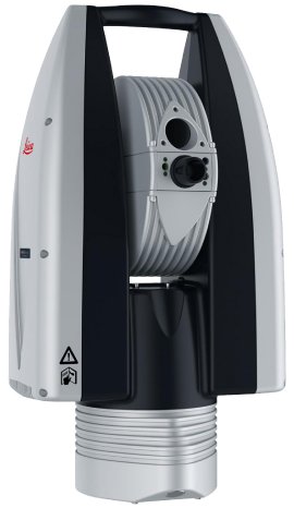
With a new generation of laser trackers, Leica Geosystems is leading its clients into a new dimension of user friendliness. With the aid of 3D coordinates and imaging elements, this system is accelerating and refining the production process. As such, Leica Geosystems attends to the growing demand from industry for higher performance in measurement and control of moving applications and production processes. As a result of this demand, the tolerance for the precision of water jet cutters, for example, is in the submillimetre range.
A key component of the new Leica measuring systems is made by imaging experts FRAMOS. For quick operation and simple application control, the measured data are shown to the operator via a monitor. The overview camera implemented into the system delivers data which is processed further by an FPGA chip. FPGAs (Field Programmable Gate Arrays) are an integrated digital circuit in which a logical circuit can be programmed. Thanks to parallel signal processing, they perform superbly while component costs remain reasonable and power consumption is relatively low. The image pre-processing is stored on this freely programmable chip. This includes, alongside individually adjusted image processing algorithms, the possibility for loss-free and individually adaptive compression for transferring data more swiftly, loss-free digital zoom, and, notably, the possibility for colour calibration.
"Here we are providing the exact know-how used in processing image data based on our experience and constant technological development, which offers Leica attractive surplus value and a directly applicable advantage to Leica clients," says Dietmar Scharf, project manager at FRAMOS.
"The sharper, high-definition overview camera image – in colour for the first time – is a significant advantage of our new systems. Along with many further improvements we thereby have a highly competitive complete package on offer, thanks to FRAMOS' many years of experience", says Burkhard Boeckem of Hexagon/Leica Geosystems. "The availability of a digital zoom, for example, makes the dimensions of the work piece, as well as the details of its processing, undoubtedly recognisable straight away. Until now the data had to be evaluated in order to make new settings and system adjustments fit exactly. Now the improved technology compensates for the shortcomings of the human eye even better; the operator can observe the monitor directly and promptly take control of the process."
Leica Geosystems - thanks to support from FRAMOS on the internal camera system of the laser tracker - has now made available a uniform interface for reading the most diverse image sources; couple this with considerably improved colour image quality and it can be seen as particularly valuable for future applications. Apart from the technical aspects, the cross-border development contributed considerably to the success of this innovative project. The hardware components made available by Leica Geosystems enabled the developmental work to mainly be carried out locally by FRAMOS. Moreover, the regular exchange between developers from Leica Geosystems and FRAMOS by using online instruments, made a crucial contribution to the progression of the project. Combined, these factors helped keep project costs low. That this progress was achieved in a combined development period of less than two years from first contact to start of production, has, according to Boeckem, "confirmed our first assessment that with FRAMOS, we have a partner at our side who brings much proficiency and experience for a very worthy price ratio."


