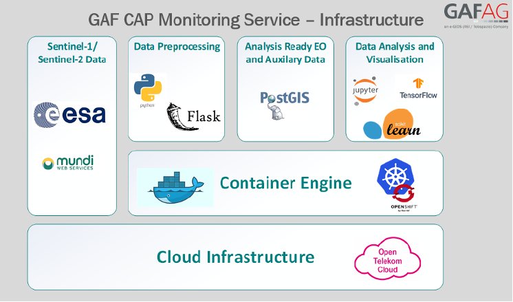
The contract runs for the next three (+1) years and covers the rapid, accurate and fully automated continuous monitoring and precise verification of numerous crop types covering the entire area of Sachsen-Anhalt, and the evaluation of compliance with agri-environmental and climate measures, using both optical and radar data from the European Copernicus Sentinel Missions.
As part of an ongoing series of reforms to the CAP, the European Commission recently decided to implement a new control system for subsidy declarations based on innovative technologies utilising automatic monitoring procedures based on Copernicus earth observation data. The new continuous and comprehensive monitoring system is intended to replace the existing system of 5% On-The-Spot (OTS) samples.
GAF’s sophisticated system and wide range of innovative digital geo-solutions provides highly accurate, systematic and regular information retrieval from earth observation data in accordance with the newest CAP requirements. Based on the machine and deep learning algorithms developed by GAF and time series analyses, verified decisions for more than 100 agricultural land-use classes are enabled. This system heralds a new era in the use of remote sensing data analysis for operational use.


