(PresseBox)
(
Key features:
3Dsurvey is developed based on 300+ land surveying projects. Tailored to serve specific surveyors’ needs. Cut fieldwork time by up to 100 times.
- Professional tool for daily use
Best price-performance digital surveying tool in the market. Combine with 3Dsurvey Pilot and 3Dsurvey Viewer to get the complete solution: Capture > Process > Analyze > View & Share.
Improved engine that utilizes both CPU and GPU for up to 15x faster image processing time. Large dataset support - 1000+ hi-res images.
Supports any drone & any camera/sensor. Works for aerial & terrestrial data acquisition methods. rTK- and EXIF GPS ready for instant telemetry data import.
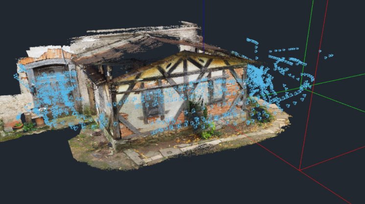
Capture and recreate natural environment in digital form and survey from the office. Achieve high-resolution outputs with cm-grade accuracy.
- Compatible with third-party sources
Supports working with any third-party point clouds, data from LiDAR, Sonar, SLAM, terrestrial scanners. Seamless workflow for further combination with photogrammetric point clouds.
Functionalities:
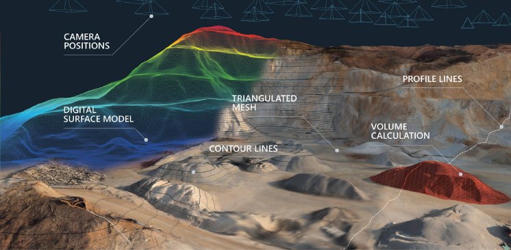
High-resolution, georeferenced orthophotos. Ideal for daily land surveying projects. Use orthophoto, contour lines, elevation models to create professional survey maps. Compatible with any GIS or CAD software.
Calculate volumes of excavated material in seconds with cm-grade accuracy. Compare and calculate multiple measurements over time or on the fly. 3D visualization and multi-layer volume/stockpile change detection.
Create vertical cross-sections from point cloud data. Draw a definition line and calculate a single vertical cross-section or calculate multiple transverse profiles with user-defined intervals. One-click export to PDF or DXF.
- Export to any third-party software
Quick export to Google Earth [kml, kmz]. Wide range of export formats for CAD or any other third-party software compatibility [tiff, geotif, jpeg, png, pdf, ply, las, txt, xyz, koo, dxf, etc.]. Further visualization in BIM software [dxf, obj].
2D and 3D CAD drawing tools. DXF file import/export for any third-party software compatibility. Draw CAD sketches/lines and topo maps directly over textured models and/or point clouds.


