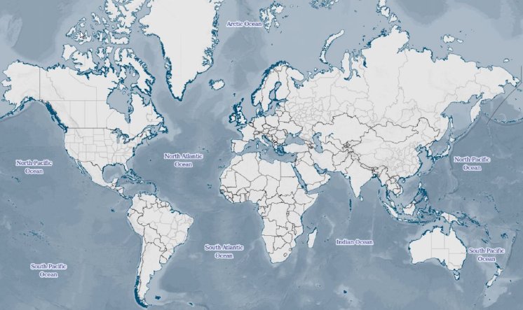
The data in Global Insight Plus provides a rich coverage of the world and includes up-to-date political mapping, coastlines, international borders, first and second level administrative borders, time zones, points of interest and over 930,000 named places with urban sprawls. Additionally layers include roads, railroads, national parks, airports, ports, rivers and lakes.
The global map forms the new standard for world reference mapping and is ideal for background mapping for a variety of applications.
As well as thousands of minor updates and enhancements the data includes the following new features in 2016.1: Superior resolution bathymetry, support for Polish, Hungarian and Czech languages - now 24 in total, time zones with updated DST for 2016/2017, updates to international and administrative boundaries. Also, two new layers supplement the comprehensive airports database, representing airport runways and perimeters.
In addition to GeoTIFF format, grid-based layers are now available in the new data format MRR (Multi-Resolution Raster) format for high performance display and analysis with MapInfo Professional software.
Ray Roberts-York, Managing Director of MB-International, comments, "We are excited to have this exceptional new release in our data portfolio. The new release of Global Insight Plus has once again raised the bar in terms of quality and global content."


