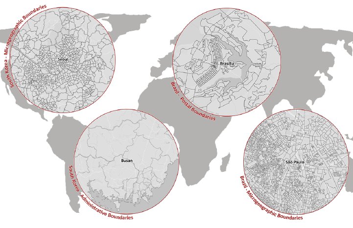
In today's highly interconnected world, accurate and up-to-date data is crucial for businesses operating across borders. Recognizing this need, MBI is proud to announce the release of its latest global boundaries data, offering significant enhancements for companies with a global presence. With their comprehensive global digital boundaries for more than 248 countries across over 1,000 geographic levels worldwide, MBI offers businesses unparalleled insights into market dynamics at a granular level.
New Features and Enhancements
In this latest release, MBI introduces several new features and enhancements aimed at providing more accurate and detailed geographic information:
New Administrative & Postcode Levels: The database now includes new administrative levels for various countries, such as Districts in the United Arab Emirates, Srok in Cambodia, and Corregimientos in Panama. It also covers new postcode levels, such as postcodes 6 and 4 for Cambodia, postcodes 5 for Mongolia, and postcodes 2 for the Cayman Islands, among others.
Key Changes: MBI has updated key changes of administrative divisions for several countries, including Azerbaijan, Bhutan, Indonesia, Jordan, North Korea, Kuwait, Kazakhstan, the Philippines, Pakistan, the Northern Mariana Islands, New Zealand, and the United States Minor Outlying Islands, ensuring alignment with the latest administrative structures.
Expanded Coverage: With new areas added, including administrative and/or postal boundaries for countries like the United States of America, New Zealand, the United Kingdom, the Netherlands, Portugal, Sweden, Israel, Mexico, Brazil, Russia, the United Arab Emirates, India, Mongolia, Cambodia, the Philippines, Pakistan, and Panama, MBI's dataset now offers even broader coverage, empowering businesses with comprehensive global insights.
Worldwide Availability and Benefits
MBI's digital boundaries serve as a valuable resource for businesses across various industries, offering many key benefits:
- Extensive Coverage: With one of the largest inventories of administrative, postal, and microgeographic boundaries, MBI provides businesses with diverse datasets to meet their specific needs.
- Accuracy: MBI's data layers are topologically correct and seamlessly integrated with neighboring countries, ensuring the highest level of accuracy.
- Regular Updates: All boundaries undergo strict quality control and are regularly updated to reflect the latest changes, ensuring up-to-date and reliable information.
- Easy Integration: Compatible with all standard GIS formats, including ESRI Shapefile (.shp), ESRI File GeoDataBase (.gdb), MapInfo TAB Extended (.tab), GeoJSON (*.geojson), and GeoPackage (*.gpkg), MBI’s digital boundaries facilitate seamless integration into existing systems.
"Our 2024 global boundaries release provides businesses with the latest, most comprehensive, and highest quality geographic data for countries around the world," said Ray Roberts-York, Managing Director at MBI. "Having accurate geospatial intelligence is empowering businesses with the insights they need to thrive in today’s competitive environment."
The updated global boundaries enable businesses across industries like logistics, retail, marketing, and more to better visualize their markets, implement strategies, plan locations, and conduct geographic analysis on a local or global scale.
For further details regarding the geographical levels available in individual countries, MBI’s competitive package prices for the complete world dataset, or specific information about countries relevant to your operations, please reach out. Our Sales Team will be delighted to assist you in maximizing the value of MBI's global digital boundaries for your business needs.


