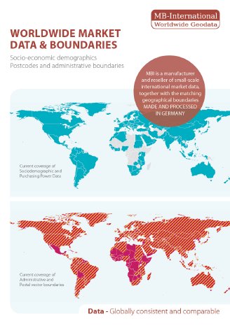
Geodata are constantly changing – every year there are numerous changes at administrative as well as at postal area level. Main reasons being cost saving, delivery area optimization or the implementation of political reforms.
“To keep up with these changes, our team of geospatial experts and data scientists are working to improve our global boundary maps and data in a continuous process,” says Mr. Roberts-York, Managing Director of Michael Bauer International GmbH. “An up-to-date data source is indispensable to avoid erroneous evaluations and consequently wrong decisions. With each new released update we strive to meet these expectations from our global customers across all industries, whether our data is used for geomarketing, location and expansion planning, social media marketing or business intelligence applications.”
MBI-Data Offering, Release 2018:
Number of countries worldwide: over 190
Number of polygones per level worldwide:
postcode level: approx. 328.777
administrative area level: approx. 184.137
small area level (micro areas) approx. 3.044.354
Number of variables*: approx.187
(*socio-demographic and economic)
Standard GIS formats for MBI vector boundaries: Esri Shape file (.shp), Esri Geodatabase (.gdb), MapInfo (.tab), MapInfo MIF/MID.
Standard formats for MBI data: Tab delimited file (TXT), Access database (MDB), Excel (xls).


