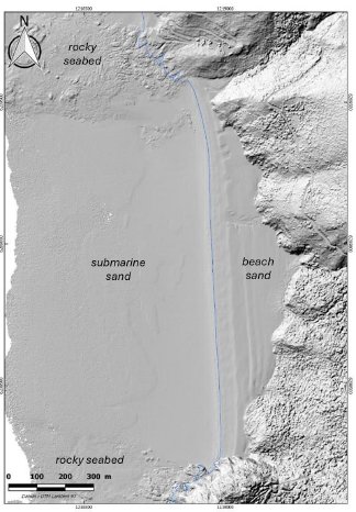
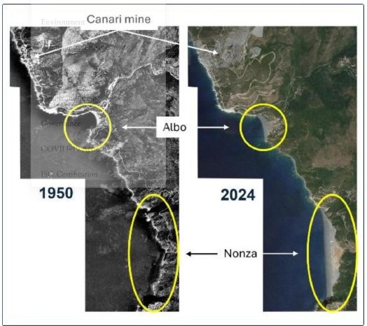
LiDAR is a remote sensing technology that penetrates through vegetation and water, producing detailed 3D images of the Earth’s surface both above and below water. Examination of the black and white LiDAR[1] image below (Figure 1), which shows Nonza Beach and the sea bottom immediately to the west of the beach, indicates a markedly different submarine topography in front of the beach. You can see the submarine areas to the north and south have an irregular topography which is due to rocky seabed. The sea bottom west of the beach is mostly smooth; the hollows have been filled in with sand. As demonstrated by historical air photos (Figure 2), it is believed that the waste from the historic Canari Mine, which had filled in the port of Nonza, also filled in and covered the sea bottom at Albo and Nonza Beaches.
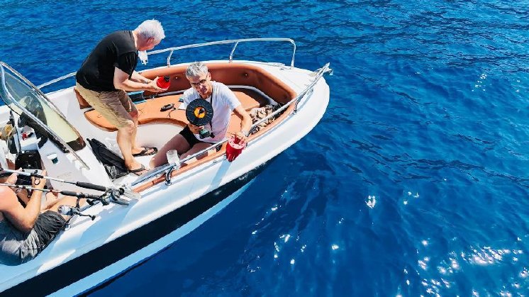
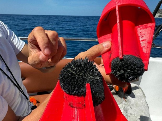
One day was spent in reconnaissance sampling of the sea bottom to test this hypothesis (Figures 3 and 4). A high field strength Sm-Nd magnet was used on the end of fishing line and an innovative reel to retrieve it was put together from a power drill by Stefan. A total of four samples were collected in front of Albo Beach and six samples in front of Nonza Beach. In each case, the magnet collected large amounts of magnetic sand off the sea bottom. Samples of this sand have been sent to ALS Chemex in Seville, Spain, for analysis. Since nickel is not present in the magnetite, any nickel in the assays would indicate the presence of awaruite.
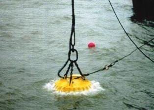
The Company has been in touch with WOKO Magnet- und Anlagenbau GmbH of Duisburg, Germany, who manufacture a marine electromagnet that possibly could be used to recover the magnetic sand. This magnet (Figure 5) is used to clean up ordnance from WWII in the sea, and to remove metal trash. We believe the recovery of sand by this method would have minimal disturbance to the environment. The sand is obviously already at the surface and is probably a bottom lag, winnowed by the currents so that the heavy metal grains are preferentially concentrated.
Qualified Persons:
The geological information contained in this news release has been verified and approved by Aurania’s VP Exploration, Mr. Jean-Paul Pallier, MSc. Mr. Pallier is a designated EurGeol by the European Federation of Geologists and a Qualified Person as defined by National Instrument 43-101, Standards of Disclosure for Mineral Projects of the Canadian Securities Administrators.
About Aurania
Aurania is a mineral exploration company engaged in the identification, evaluation, acquisition, and exploration of mineral property interests, with a focus on precious metals and copper in South America. Its flagship asset, The Lost Cities – Cutucú Project, is located in the Jurassic Metallogenic Belt in the eastern foothills of the Andes mountain range of southeastern Ecuador.
Information on Aurania and technical reports are available at www.aurania.com and www.sedarplus.ca, as well as on Facebook at https://www.facebook.com/auranialtd/, Twitter at https://twitter.com/auranialtd, and LinkedIn at https://www.linkedin.com/company/aurania-resources-ltd-.
For further information, please contact:
Carolyn Muir
VP Corporate Development & Investor Relations
Aurania Resources Ltd.
(416) 367-3200
carolyn.muir@aurania.com
Neither the TSX Venture Exchange nor its Regulation Services Provider (as that term is defined in the policies of the TSX Venture Exchange) accepts responsibility for the adequacy or accuracy of this release.
Forward-Looking Statements
This news release contains forward-looking information as such term is defined in applicable securities laws, which relate to future events or future performance and reflect management’s current expectations and assumptions. The forward-looking information includes Aurania’s objectives, goals or future plans, statements, exploration results, potential mineralization, the tonnage and grade of mineralization which has the potential for economic extraction and processing, the merits and effectiveness of known process and recovery methods, the corporation’s portfolio, treasury, management team and enhanced capital markets profile, the estimation of mineral resources, exploration, timing of the commencement of operations, the Company’s teams being on track ahead of any drill program, the commencement of any drill program and estimates of market conditions. Such forward-looking statements reflect management’s current beliefs and are based on assumptions made by and information currently available to Aurania, including the assumption that, there will be no material adverse change in metal prices, all necessary consents, licenses, permits and approvals will be obtained, including various local government licenses and the market. Investors are cautioned that these forward-looking statements are neither promises nor guarantees and are subject to risks and uncertainties that may cause future results to differ materially from those expected. Risk factors that could cause actual results to differ materially from the results expressed or implied by the forward-looking information include, among other things: failure to identify mineral resources; failure to convert estimated mineral resources to reserves; the inability to complete a feasibility study which recommends a production decision; the preliminary nature of metallurgical test results; the inability to recover and process mineralization using known mining methods; the presence of deleterious mineralization or the inability to process mineralization in an environmentally acceptable manner; commodity prices, supply chain disruptions, restrictions on labour and workplace attendance and local and international travel; a failure to obtain or delays in obtaining the required regulatory licenses, permits, approvals and consents; an inability to access financing as needed; a general economic downturn, a volatile stock price, labour strikes, political unrest, changes in the mining regulatory regime governing Aurania; a failure to comply with environmental regulations; a weakening of market and industry reliance on precious metals and base metals; and those risks set out in the Company’s public documents filed on SEDAR+. Aurania cautions the reader that the above list of risk factors is not exhaustive. Although the Company believes that the assumptions and factors used in preparing the forward-looking information in this news release are reasonable, undue reliance should not be placed on such information, which only applies as of the date of this news release, and no assurance can be given that such events will occur in the disclosed time frames or at all. The Company disclaims any intention or obligation to update or revise any forward-looking information, whether as a result of new information, future events or otherwise, other than as required by law.
[1] The LiDAR data is public access: Coastal altimetry - Litto3D® | Shom
